Maps
Having completed Cartography: Digital Mapping from the College of Geographic Sciences in 1998, we were still taught manual techniques including darkroom, pen & ink, diazo, and scribing, none of which are currently being used to the best I my knowledge! There have since been many changes to the mapping industry, but all these techniques provided me with a strong knowledge base in the importance of legibility, typography, and design to assist in relaying information to the end user.
The digital mapping software I learned while in college included CorelDraw and Adobe Illustrator, which began my career in graphic design before I ever went back to college to take the graphic design program in 2000.
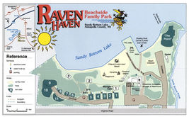
The maps on the left were created using either one of those software packages or ESRI ArcMap.


